Research areas

We take a multi-disciplinary approach to conduct fundamental and applied research that delivers tangible benefits to society, industry, and government.

About our research

The research encapsulates satellite positioning and tracking, GPS meteorology, atmospheric studies, geodesy and surveying.

Primary research objectives

  • Develop new algorithms and enhanced atmospheric models to enhance Australia’s capabilities in space research
  • Develop new generation GNSS programs that will increase the accuracy of weather monitoring techniques and enhance understanding of the impact of climate change on Australia
  • Investigate advanced platform technologies for space tracking and navigations, precise satellite positioning, space weather, atmospheric modelling and climate monitoring
  • Develop Radio Occultation technology that incorporates GNSS and LEO satellites to study atmosphere, ionosphere and space weather
  • Investigate the effects of the magnetosphere and atmospheric regions on ray path trajectories
  • Investigate atmospheric mass density models to improve the reliability and efficiency of space surveillance systems
  • Improve research methodologies in space object orbit predictions and enhance current space object catalogues

Key focus areas

  • Space situational awareness
    The Centre has expertise in accurate monitoring of space environment using precise orbit determination techniques, debris surveillance and satellite-based technologies. This is important for accurate GNSS radio occultation, in-space tracking and navigation, as well as the maintenance and operation of satellites.
  • Space weather and atmospheric modelling
    A key focus of the Centre is to model the nuances and chaotic pattern systems in the atmosphere and space that are an integral part of space weather, climate science, environmental monitoring and precise positioning.
  • Satellite navigation and geodesy
    The Centre conducts research in geodesy, developing new algorithms to provide precise and fit-for-purposes positioning, navigation and timing information using GNSS technology to new business applications and services.
  • Integrated and cooperative positioning
    The Centre undertakes research in integrated and cooperative positioning focusing on multi-sensor systems to support intelligent transportation systems and smart people and object mobility. It also focuses on alternatives/backups to GNSS technology.

To achieve these research objectives the Centre’s research is divided up into four main research foci.

Main research foci

Space debris evolution modelling investigates the population development of the objects present in space.

Real-time precise orbit determination (POD) and precise positioning are fundamental requirements for space situational awareness (debris surveillance, collision warning and avoidance), accurate GNSS radio occultation, in-space tracking and navigation, as well as the maintenance and operation of satellites.

Space debris evolution modelling is an important procedure to measure and predict the space appropriateness for human explorations. That is, active debris removal measures have to be taken to prevent occurrence of a collisional cascading effect - the so called Kessler Syndrome. This has the potential to end space operations. Any attempt at removing debris objects requires an accurate knowledge of the objects’ positions. A large aspect of the debris problem is that only a fraction of debris objects are tracked and catalogued, most with low to moderate accuracy levels. Many objects capable of rendering a satellite inoperable are not tracked.

Precise orbit determination and prediction are extremely important for reliable collision warning services. Improvements need to be made in the accuracy of the orbit prediction for collision warning systems to protect assets and reduce the chance of contributing to the debris problem by increased occurrence of collisions between satellites.

Under a collaborative effort between RMIT and its collaborative partners, improved methods and algorithms are being developed using satellite laser ranging, optical and GNSS measurements for real-time POD, precise positioning and atmospheric mass density modelling. A suite of advanced software and system platforms will also be developed to enhance Australia’s capabilities in space research.

The SPACE Research Centre is actively researching the following topics:

  • Precise orbit determination, in-space service
  • Debris surveillance and collision avoidance
  • Satellite Laser Ranging (SLR), Square Kilometre Array (SKA)

Climate change and associated hazards such as tropical cyclones, drought, extreme heat and bushfires are serious problems faced by Australia.

The insufficient density of ground-based meteorological observation stations (especially in the Southern Hemisphere) and the lack of accurate data over the World’s oceans and Polar Regions significantly limits the accuracy and reliability of current climate models. As such it is important to develop and evaluate new observational techniques to gain an improved understanding of climate change in the Australian region. Satellite-based remote sensing provides a low-cost, powerful means of precisely measuring characteristics of the Earth’s environment on a global scale. Our mission is to explore the acquisition, data processing and models that the new generation GNSS and new geo-environmental satellite programs offer for space, atmosphere and climate research, particularly in an Australian context.

This research will serve as a catalyst for the development of future Australian LEO satellite(s) and understanding of space weather and climate change. This initiative is an important step in providing Australia with space-based technology platforms and a data portal suitable for generating a world class high-resolution analysis of climate conditions. This will be of great benefit in understanding the current status and trends in climate and potential environmental hazards and will be of assistance in planning for mitigation of climate change impact on Australia.

The SPACE Research Centre is currently researching the following topics in atmospheric modelling:

  • Precise positioning
  • Space weather/ solar activities, ionosphere
  • Weather forecasting, climate monitoring and climatic hazards
  • Environmental monitoring

Global Navigation Satellite Systems (GNSS) have many applications in modern society and form the critical geospatial infrastructure needed for precise positioning (with cm-level or better accuracy).

The rapid development and launch of new GNSS constellations will increase the accuracy, reliability and integrity of real-time GNSS precise positioning, creating a platform to extend current capabilities in this field.

GNSS Network real-time kinematic (NRTK) positioning and precise point positioning (PPP) are the two most commonly used techniques for real-time high accuracy positioning. The performances of these two techniques are still limited due to the fact that various errors currently cannot be mitigated or modelled effectively in real-time mode. This significantly affects the speed and accuracy of the ambiguity resolution and the positioning. Algorithms for atmospheric error modelling and carrier phase ambiguity resolution are critical for improving state of the art precise GNSS positioning technologies.

The SPACE research centre focuses on new methods and algorithms for regional atmospheric error modelling and carrier phase ambiguity resolution using multi-GNSS systems, NRTK and PPP techniques. It also aims to develop a near real-time PPP system based on multi-GNSS constellations using high accuracy single frequency receivers. The outcomes of this research will have a significant impact on improving the performance of GNSS precise positioning and advancing current GPS research.

Current research topics are as follows:

  • Multi-GNSS , Network Real-Time Kinematic (RTK), Precise Point Positioning (PPP)
  • Radio Occultation and GNSS meteorology
  • Positioning, Navigation and Timing (PNT)
  • Surveying and geodesy
  • Ray tracing and reflectometry
  • Structural and engineering deformation monitoring and detection
  • Integration of GPS, INS, GIS and other geospatial technologies

The ability to undertake precise indoor/outdoor positioning and tracking of people and objects is vital to modern society.

It supports an enormous range of significant applications in areas such as national security and defence, emergency services, asset management, sales and marketing, traffic controls, personal navigation, and elite athlete monitoring during training and competition. These applications may be as simple as tracking the location of a valuable shipping carton or detecting the whereabouts of a thief/terrorist, or as complex as helping someone to navigate in an unfamiliar building during a crisis.

RMIT University is recognised as a world leader in precise athlete monitoring using miniaturised GPS-based devices, through its strong association with partner organisations, such as the Australian Institute of Sport, CRC and Catapult Innovations Ltd.

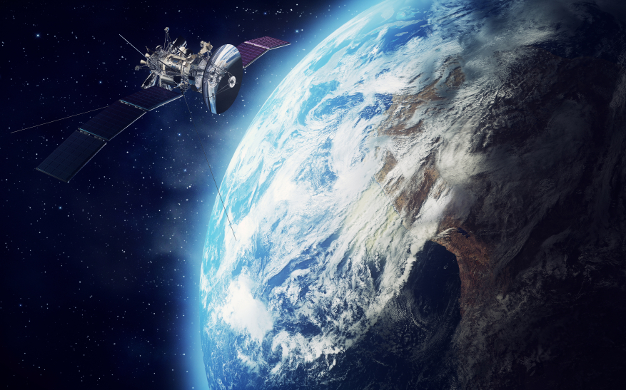
To date, GPS has become a widely used technique for locating and tracking. There are however a few drawbacks associated with low-cost GPS receivers including; signal jamming, obstruction, interference and relatively low sampling rates. The integration of GPS and other positioning techniques, such as A-GPS, INS, ZigBee, WiFi and radio identification (RFID) cell-of-origin or fingerprinting positioning techniques, may extend the positioning applications into seamless indoor/outdoor positioning and people mobility tracking. For example, high sampling rate, small volume MEMS INS can be used in tracking athletes and low-cost, long-range RFID systems can be used as positioning land marks to cover the GPS outage areas.

This research will provide significant contributions in ubiquitous positioning and location based services and will focus on the following core research topics:

  • Innovative applications, smart athlete training and coaching systems, precise robotic control
  • Positioning/ tracking indoor/ outdoor and in different environments
  • Micro-GPS and multiple sensor GPS integration for Location Based Services (LBS)
  • Intelligent Transportation Systems (ITS)
  • Physical geodesy, land registry and land management
aboriginal flag
torres strait flag

Acknowledgement of Country

RMIT University acknowledges the people of the Woi wurrung and Boon wurrung language groups of the eastern Kulin Nation on whose unceded lands we conduct the business of the University. RMIT University respectfully acknowledges their Ancestors and Elders, past and present. RMIT also acknowledges the Traditional Custodians and their Ancestors of the lands and waters across Australia where we conduct our business - Artwork 'Luwaytini' by Mark Cleaver, Palawa.

aboriginal flag
torres strait flag

Acknowledgement of Country

RMIT University acknowledges the people of the Woi wurrung and Boon wurrung language groups of the eastern Kulin Nation on whose unceded lands we conduct the business of the University. RMIT University respectfully acknowledges their Ancestors and Elders, past and present. RMIT also acknowledges the Traditional Custodians and their Ancestors of the lands and waters across Australia where we conduct our business.