Bachelor of Science - Geospatial Sciences major

Bachelor of Science - Geospatial Sciences major

Your guide to majoring in geospatial sciences with the Bachelor of Science at RMIT.

Student type:
Learning mode:
On campus
Duration:
Full-time 3 years
Part-time 6 years
Next intake:
February, July
Location:
Melbourne City
Learning mode:
On campus
Entry score:

See admissions

Duration:
Full-time 3 years
Fees:

AU$38,400 (2024 annual)

Next intake:
February, July
Location:
Melbourne City

Introduction to the major

The Geospatial Science major in the Bachelor of Science at RMIT equips you with the applied skills and knowledge required for discovering relationships between places, people and the environment, while gaining valuable real-world and industry experience.

Delve into the fascinating realm of maps and spatial analysis. Unleash your curiosity as you explore the world from a unique perspective. Dive into satellite imagery and laser sensors, GPS technology, geographic information systems (GIS), digital twins, virtual reality, robots and artificial intelligence. Use your skills in mapping and spatial data analysis to contribute towards UN sustainable development goals.

In our program, you will meet many passionate and dedicated professionals who share their knowledge through invited lecturers, capstone project supervisions, internships and fieldwork. You can undertake one-of-a-kind work placement locally, interstate and overseas, building a global network and boosting career opportunities. We also partner with key players operating in the global geospatial market including Google, ESRI Australia, Trimble, Leica, and Hexagon.

Our industry-ready graduates are employed across multiple sectors including transportation, defence, engineering, environment, infrastructure, health, agriculture and policymaking.
About the Bachelor of Science

With the Bachelor of Science at RMIT you will enjoy a cross-disciplinary, flexible and personalised degree that allows you to pursue a range of diverse interest areas across business. You will gain practical real-world experience throughout your degree.

Why choose to major in geospatial science with the Bachelor of Science?

Graduate employability

Geospatial Science is one of the fastest growing sectors globally. Our students are in high demand.

Industry engagement

Our embedded work-integrated learning offers the opportunity to work while studying.

Positive learning environment

Engage with staff and peers, making friends as you learn within a caring and inclusive community.

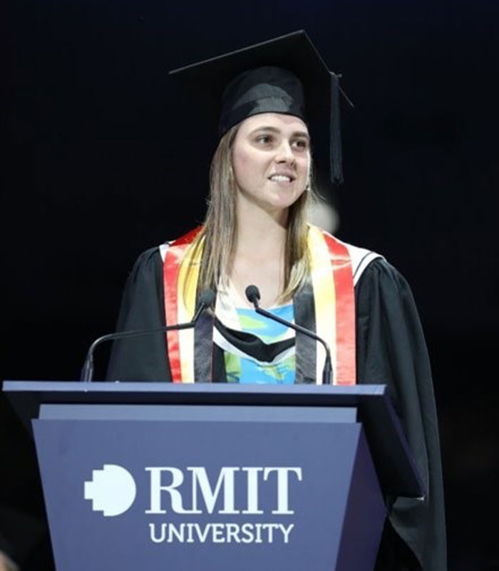
Caley Manzie, Bachelor of Science (Geospatial Science, Honours)
Geospatial Science is used and explored within different fields of work, and students get the opportunity to develop these skills in both real and simulated projects to best prepare us for when we begin our career after university.

- Caley Manzie, Bachelor of Science (Geospatial Science)

Career outcomes

RMIT’s Bachelor of Science will equip you with the expertise, experience and professional skills to have a successful career as a scientist.

With the practical, research and soft skills developed and gained through your study in this degree, you can go on to work or undertake further study in a range of areas.

Graduates of Geospatial Science can work for a diverse range of exciting industry and government organisations, including conservation, planning, mapping, demographic marketing, emergency services, statutory authorities, government, manufacturing, finance, insurance, agriculture, forestry, transportation, weather monitoring, climate change modelling, recreation and tourism.

Potential careers for graduates of the Bachelor of Science who choose to major in geospatial sciences include:

  • geospatial analyst
  • remote sensing scientist
  • geospatial engineer
  • science communication officer
  • technical consultant
  • cartographer
  • photogrammetrist
  • geodesist.

Subject selection guide

The following guide will help you understand what your subject plan will look like if you decide to major in geospatial sciences with the Bachelor of Science:

You will undertake eight courses focusing on:

  • Spatial Thinking
  • Mapping the World
  • Mathematics for Surveying & Geomatics A
  • Applied Geospatial Techniques
  • Geospatial Programming
  • Spatial Information Science Fundamentals
  • Earth Observation Science
  • Advanced Spatial Information Science

Bachelor of Science full course information

This is just one of the 8 majors that you can choose from. Visit the Bachelor of Science course page to find full course information, explore your study options, and get details on entry requirements, pathways, fees, plan structure and more.

aboriginal flag
torres strait flag

Acknowledgement of Country

RMIT University acknowledges the people of the Woi wurrung and Boon wurrung language groups of the eastern Kulin Nation on whose unceded lands we conduct the business of the University. RMIT University respectfully acknowledges their Ancestors and Elders, past and present. RMIT also acknowledges the Traditional Custodians and their Ancestors of the lands and waters across Australia where we conduct our business - Artwork 'Luwaytini' by Mark Cleaver, Palawa.

aboriginal flag
torres strait flag

Acknowledgement of Country

RMIT University acknowledges the people of the Woi wurrung and Boon wurrung language groups of the eastern Kulin Nation on whose unceded lands we conduct the business of the University. RMIT University respectfully acknowledges their Ancestors and Elders, past and present. RMIT also acknowledges the Traditional Custodians and their Ancestors of the lands and waters across Australia where we conduct our business.