Associate Dean of Geospatial Sciences, Professor Matt Duckham, said it was exciting to see RMIT recognised for its incredible breadth of expertise across every aspect of geospatial sciences.
“There is simply no comparable group in Australia, and very few groups today in the world that can claim such a breadth and depth of geospatial expertise,” he said.
“This award comes at a particularly important time, both internationally and nationally, as society increasingly relies on spatial data and spatial technologies.
“Receiving this wonderful recognition helps RMIT tell our story and better connect our research to where it has impact in government, industry, and the wider society.”
Geospatial Sciences are fundamental in almost every area of human activity, from locating and navigating autonomous vehicles, predicting disruption to flights or electricity networks from space weather events, detecting bushfires in minutes from space, and building tomorrow's smart cities and resilient societies.
The award winners were commended for their enthusiasm and innovative thinking in their area of expertise, developing dramatic advancements in technologies, and a commitment to driving the industry towards the future.
RMIT Geospatial Science is continuously developing remarkable ideas and new solutions to critical challenges in society.
Take a look at some recent innovative research.
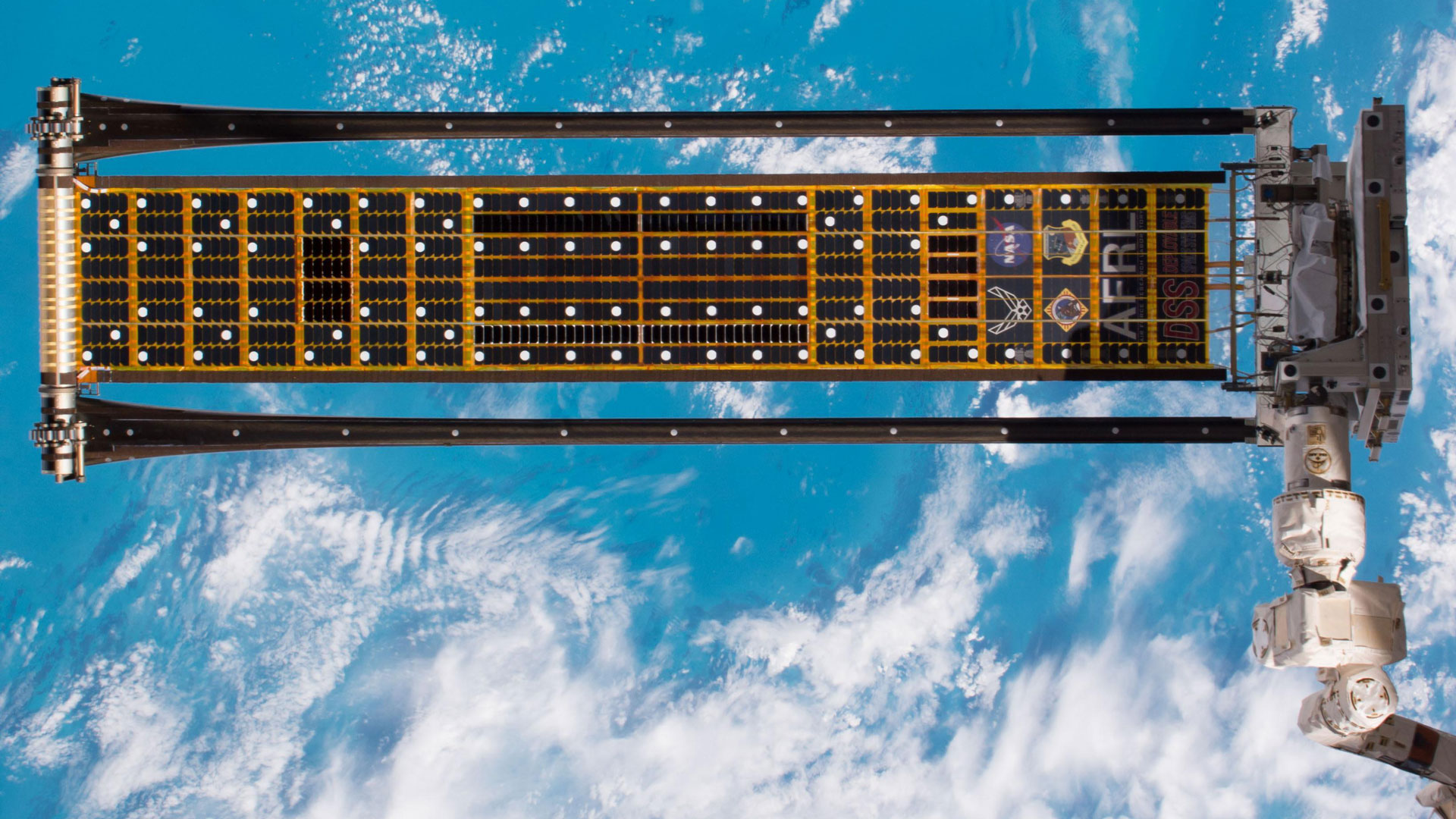
Pushing boundaries with NASA
Professor Mark Shortis was part of a NASA team testing better ways to capture solar energy on the International Space Station.
The experiment involved unravelling a new type of lightweight and compact solar array, or group of solar panels, called the roll-out solar array (ROSA).
Shortis’ expertise in photogrammetry, which allows precise positioning from imagery, has helped to develop the specialised software to efficiently track the targets on the solar array as it deploys, and ensure the array deploys in space correctly.
Space debris solutions
Geospatial Science Professor Kefei Zhang and his team from SPACE Research joined with researchers from Electro Optic Systems and Japan’s National Institute of Information and Communications Technology as part of the Space Environment Research Centre (SERC) to help track hazardous space debris as it travels in orbit at several kilometres per second.
They are working on a capability to use lasers to push debris out of the way to avoid potentially damaging collisions with satellites.
Mobile tech against bushfires
Bushfire and Natural hazards CRC project, Fuels 3D, led by Associate Professor Karin Reinke and Professor Simon Jones, mapped and characterised fire landscapes in Australia to provide the science behind a ground-breaking mobile smartphone app.
The app, which has been trialled by several state fire authorities and land management agencies in Australia, will be able to more cheaply and reliably determine the amount of fuel in fire-prone forest environments.
The work was recognised with a 2017 Victorian Spatial Excellence Award.
Climate change resilience
Associate Professor David Mitchell and Vice-Chancellor's Research Fellow Dr Serene Ho are using their expertise in land tenure and land administration on a United Nations-funded project enhancing the resilience of the people of the Solomon Islands to climate impacts and natural disasters.
Led by RMIT's Professor Darryn McEvoy, Climate Resilient Honiara is funded by the UNFCCC Adaptation Fund and aims to reduce the vulnerability of urban poor communities in five informal settlements.
Story: Jasmijn van Houten