Study backs expansion of footpaths and outdoor dining for Melbourne
New research from urban planning experts has for the first time detailed how inner-city suburbs lack footpath space – increasingly vital real estate amid strict indoor dining capacity limits.
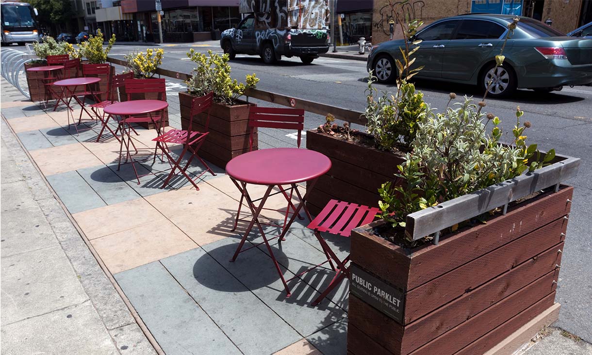
As Melbourne embarks on a spring awaking, businesses are looking to the streets to keep the doors open.
Now there’s evidence the temporary footpath extensions made by several councils should be made permanent, with the study revealing traffic to pedestrian ratios were always out of whack in many shopping strips.
The research into 57 inner-city Melbourne shopping strip locations found pedestrians and outdoor diners are being short changed, only given 33% of street space despite accounting for 56% of the traffic.
Lead researcher Dr Chris De Gruyter from RMIT’s Centre for Urban Research said it’s time to think smarter about how we divvy up precious street space.
“We found there’s an undersupply of space for pedestrians, compared to what’s given to parked cars, motorists and other road users,” he said.
“As governments look to increase outdoor dining and activity spaces, they’re rethinking the layouts of shopping strips.”
“Now we have proof these should not be temporary measures – we need to share the space effectively and adapt as trends change.”
At the popular Puckle Street shops in Moonee Ponds, for example, pedestrians accounted for more than 80% of those using the street but were given only 35% of the street space, in the form of footpaths.
Out of the 22% worth of space allocated for car parking, those parking cars only accounted for 7.5% of all people using the shopping strip.
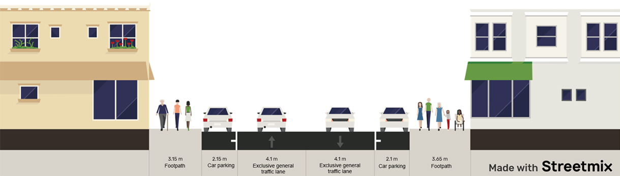 Cross section of Puckle Street, Moonee Ponds.
De Gruyter said his research into street space allocation, the first of its kind in Australia, should empower councils like Moonee Valley – where mayor Cam Nation recently floated the idea of shutting down a street to motorists over summer in favour of outdoor dining parklets – to make informed decisions.
“Street space is hotly contested, particularly where high traffic flows conflict with popular places and key destinations,” he said.
“But we knew little about what was allocated and used by each mode of transport in cities, despite the importance of fairly allocating street space.”
The study also found exclusive tram lanes were only slightly oversupplied (average of 22% of total space versus 18% of total people), as were shared general traffic/tram/bus lanes (35% of total space versus 30% of total people).
However, other street elements were greatly oversupplied on average, particularly bicycle lanes (12% of total space versus 2% of total people), car parking (21% of total space versus 13% of total people) and shared general traffic/bus lanes (42% of total space versus 29% of total people).
Despite the oversupply of space for bicycle lanes, De Gruyter said usage would certainly increase if they were more than just a painted white line and converted to Copenhagen style lanes, which are separated from car lanes.
Between October and December 2020, researchers measured each site in terms of the amount of street width provided to each mode of transport, including shared space.
They returned to some locations in March and April 2021 – during relaxed COVID restrictions – and found the overall conclusions were the same: street space for pedestrians was undersupplied and could be increased at some places through converting existing on-street parking.
With cities increasingly looking to embrace sustainable transport, like walking, cycling and public transport, knowing how much space to give to each mode is crucial.
“It is also relevant in the context of COVID, where more space is being sought to support physical distancing and outdoor gatherings,” De Gruyter said.
De Gruyter is continuing to inform local governments on how their streets are used to provide an evidence base for planning decisions.
‘Street space allocation and use in Melbourne’s activity centres’, with Chris De Gruyter, Seyed Mojib Zahraee of RMIT University and William Young of Monash University, is published by RMIT’s Centre for Urban Research.
For interviews: Aeden Ratcliffe, RMIT Communications: +61 3 9925 3336 or aeden.ratcliffe@rmit.edu.au.
- Research
- Urban Design
Acknowledgement of Country
RMIT University acknowledges the people of the Woi wurrung and Boon wurrung language groups of the eastern Kulin Nation on whose unceded lands we conduct the business of the University. RMIT University respectfully acknowledges their Ancestors and Elders, past and present. RMIT also acknowledges the Traditional Custodians and their Ancestors of the lands and waters across Australia where we conduct our business - Artwork 'Sentient' by Hollie Johnson, Gunaikurnai and Monero Ngarigo.